Surveying Services
Highway & Transportation Projects
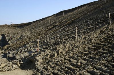
We provide precise surveying services for the planning, design, and construction of highways, roads, and transportation networks. Our expertise includes alignment surveys, grading, cross-sectioning, and setting out control points for earthworks, ensuring smooth project execution from start to finish
Mining & Large Earthworks
GeoStratos Surveys specializes in surveying for mining operations and large earthworks projects. Whether it's excavations, cut-and-fill operations, or site preparation for resource extraction, we deliver accurate data to guide operations and ensure compliance with safety and regulatory standards.
Pipeline & Utility Corridors
Our surveying services for pipeline and utility corridor projects include alignment, route planning, and construction control. We support the installation and maintenance of pipelines, electrical lines, and other utility systems, ensuring precise positioning, regulatory compliance, and minimal disruption to surrounding environments.
UAV / Drone Mapping & Photogrammetry
Using UAV (unmanned aerial vehicle) technology, we provide high-resolution aerial mapping and photogrammetry services. This allows for fast, accurate site surveys, particularly in challenging or large areas, producing detailed 3D models, topographic maps, and volumetric calculations without the need for traditional ground-based surveying.
Expert Testimony
Our experienced surveyors can provide expert testimony in legal proceedings related to land surveying. We have extensive knowledge of the industry and can provide valuable insights and analysis.